From time to time, I get questions about how the ZIP+4 and DPC (Delivery Point Code, previously known as Delivery Point Barcode, or DPBC) are assigned.
A previous Utility Information Pipeline addressed (no pun intended!) mailing address quality. That issue described how to look up a ZIP+4 and the corresponding Delivery Point Code, but it didn’t describe them. An earlier issue explaining Intelligent Mail Barcodes touched briefly on how they are assigned, but didn’t go into great detail.
What does a ZIP+4 represent?
Here is an illustration using a map of a random street in Raleigh (chosen simply because it is laid out in a traditional block, not with curved streets and cul-de-sacs, like many neighborhoods):
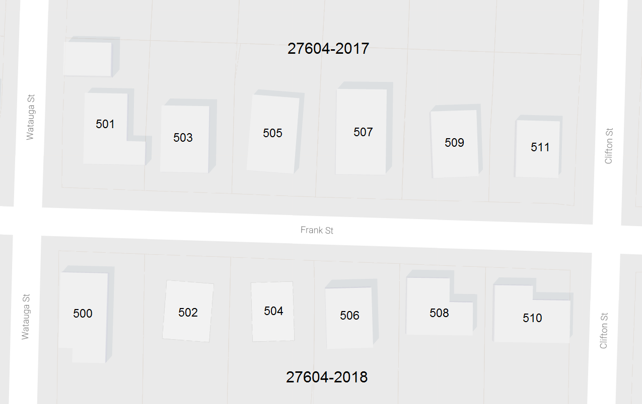
Frank Street is in Raleigh ZIP code 27604.
For residential addresses, the ZIP+4 represents the odd or even side of a block. In this example, the ZIP+4 is 27604-2017 for odd side of the 500 block of Frank Street and 27604-2018 for the even side of the block.
What does the DPC represent?
As you can see from the map, mail sorted to the ZIP+4 includes multiple addresses. For example, 27604-2017 includes the odd numbered addresses from 501 Frank Street through 511 Frank Street.
To improve upon this, the US Postal Service introduced the DPC which, when appended to the ZIP+4, creates a unique 11-digit number for every residential address. The DPC is the last two digits of the street number (or the post office box for PO Box addresses). Thus, 501 Frank Street becomes 27604-2017-01 and 503 Frank Street becomes 27604-2017-03, creating a unique numbering scheme for every address.
I’ve actually done a data matching project for a customer using this. We linked county tax information to their utility billing database using the 11-digit ZIP+4 and DPC as the initial link between addresses in the disparate systems.